These maps were created by Dr. Paul Lorah in the Department of Earth, Environment and Society.
Inspiration came from the National Park City organization and the Homegrown National Park Project. ArcGIS Pro ModelBuilder was used to generate a wilderness continuum model which served as the foundation of this map series.
Metadata:
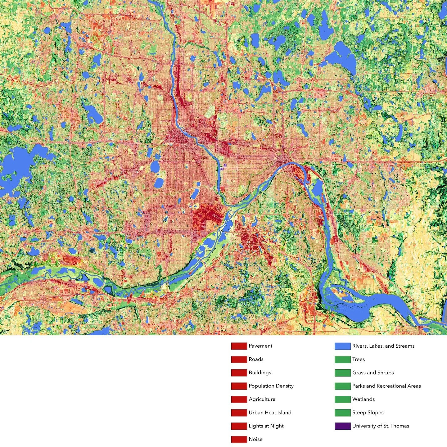
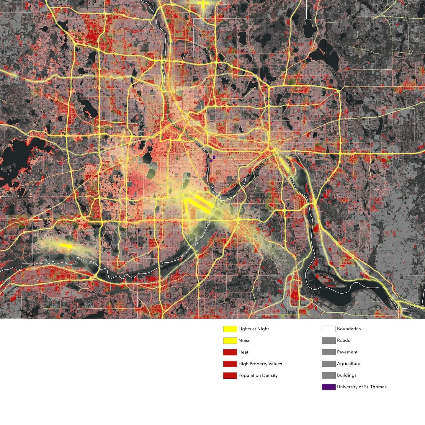
2020 Dasymetric Population for the Conterminous United States, Alaska, Hawaii, Puerto Rico, and the US Virgin Islands. US EPA Office of Research and Development EnviroAtlas Coordinator.
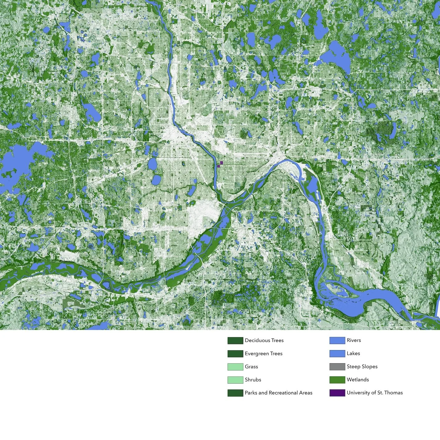
Generalized Land Use 2020. Metropolitan Council.
Land Surface Temperature 2022, Twin Cities. Derived from: Ermida, S.L., Soares, P., Mantas, V., Göttsche, F.-M., Trigo, I.F., 2020. Google Earth Engine open-source code for Land Surface Temperature estimation from the Landsat series. Remote Sensing, 12 (9), 1471.
Metro Regional Parcel Dataset (Year End 2023). Met Council GIS and Counties of Anoka, Carver, Dakota, Hennepin, Ramsey, Scott and Washington.
Metro Road Centerlines. MetroGIS and the Metropolitan Council.
Minnesota Digital Elevation Model - 30 Meter Resolution. Minnesota Department of Natural Resources.
TCMA 1-Meter Urban Tree Canopy Classification. Remote Sensing and Geospatial Analysis Laboratory, University of Minnesota.
USA Transportation Noise - Rail, Road, and Aviation 2020.
ESRI Living Atlas. Layer created from: Modeled combined railroad, road, and aviation noise (2020 version) from US Department of Transportation Bureau of Transportation Statistics (USDOT BTS).
VIIRS Nighttime Lights Monthly Cloud-Free Composite is produced using average radiance composite images from the Visible Infrared Imaging Radiometer Suite (VIIRS) Day Night Band (DNB). (Beta) Esri, Earth Observation Group - Colorado School of Mines Payne Institute for Public Policy, NOAA, NASA.